After March 1, one-night reservations are permitted for non-remote /RV and lean-to sites weekdays (Sun - Thurs) for the remainder of the season.


Header Menu Button mobile
Attention: There are no showers at this park.
Due to limited parking capacity, carpooling to Underhill State Park is recommended. In times of peak visitation, visitors may need to park along Mountain Road below the State Park entrance.

Underhill State Park, VT

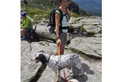
This park is probably best known for its hiking. There are four trails to the summit ridge of Mt. Mansfield from Underhill State Park. Walking up the gated road from the park headquarters, the trails begin branching off shortly above the group camp area. The Sunset Ridge Trail, 3...
Status: Closed through Thu May 23 2024   Season Dates
Max reservation window:   View all
Alerts and Important Information

Book a Campsite at Underhill State Park, VT

Enter Dates

Narrow Results


Common Attributes Group
Find your spotFind other facilities on map
     Available online       Not Available  
Campsite Search Results: 1-18 of 18 Previous | Next
Max # of people
Equip length/ Driveway
Amenities
Underhill State Park
Lean-to Walk-in
8
Electric Hookup - no Full Hookup - no
Pets Allowed Near Water - no
Underhill State Park
Campsite Tent Only
8
Electric Hookup - no Full Hookup - no
Pets Allowed Near Water - no
Underhill State Park
Campsite Tent Only
8
Electric Hookup - no Full Hookup - no
Pets Allowed Near Water - no
Underhill State Park
Campsite Tent Only
8
Electric Hookup - no Full Hookup - no
Pets Allowed Near Water - no
Underhill State Park
Campsite Tent Only
8
Electric Hookup - no Full Hookup - no
Pets Allowed Near Water - no
Underhill State Park
Campsite Tent Only
8
Electric Hookup - no Full Hookup - no
Pets Allowed Near Water - no
Underhill State Park
Campsite Tent Only
8
Electric Hookup - no Full Hookup - no
Pets Allowed Near Water - no
Underhill State Park
Campsite Tent Only
8
Electric Hookup - no Full Hookup - no
Pets Allowed Near Water - no
Underhill State Park
Campsite Tent Only
6
Electric Hookup - no Full Hookup - no
Pets Allowed Near Water - no
Underhill State Park
Campsite Tent Only
8
Electric Hookup - no Full Hookup - no
Pets Allowed Near Water - no
Underhill State Park
Campsite Tent Only
8
Electric Hookup - no Full Hookup - no
Pets Allowed Near Water - no
Underhill State Park
Lean-to Walk-in
8
Electric Hookup - no Full Hookup - no
Pets Allowed Near Water - no
Underhill State Park
Lean-to Walk-in
8
Electric Hookup - no Full Hookup - no
Pets Allowed Near Water - no
Underhill State Park
Lean-to Walk-in
8
Electric Hookup - no Full Hookup - no
Pets Allowed Near Water - no
Underhill State Park
Lean-to Walk-in
8
Electric Hookup - no Full Hookup - no
Pets Allowed Near Water - no
Underhill State Park
Lean-to Walk-in
8
Electric Hookup - no Full Hookup - no
Pets Allowed Near Water - no
Underhill State Park
Group Tenting
75
Electric Hookup - no Full Hookup - no
Pets Allowed Near Water - no
Underhill State Park
Sheltered Tentsite
8
Electric Hookup - no Full Hookup - no
Pets Allowed Near Water - no
Campsite Search Results: 1-18 of 18 Previous | Next
** Same-day reservations must be made by calling the park directly.
Overview

Description

This park is probably best known for its hiking. There are four trails to the summit ridge of Mt. Mansfield from Underhill State Park. Walking up the gated road from the park headquarters, the trails begin branching off shortly above the group camp area. The Sunset Ridge Trail, 3 miles to the summit, is the most popular. Vermont's Long Trail traverses the summit ridge and, with several trails from the other side of the mountain, many loops are possible. Hiking information and trail maps are available at the park headquarters.

Geography:

This park is within Vermont's 40,400-acre Mt. Mansfield State Forest. On the headwaters of the Brown's River, at about 2,000 feet elevation, the park lies on the west slope of 4,300 feet Mt. Mansfield, the state's highest peak. Just over the summit ridge is the Stowe ski area, one of North America's original ski resorts. The elevation and corresponding exposure to harsh climatic conditions have resulted in some relatively unusual vegetation types along the mountain's summit ridge. The low, stunted-plants found in the alpine tundra near the summit, very rare in New England, are more typical of types found on broad expanses of Arctic tundra a thousand miles farther north. These plants are fragile (if you hike to the summit, please stay on marked trails).

Recreation:

Excellent camping, hiking and picnicking.

Facilities:

11 tent sites and 6 lean-tos, restrooms with flush toilets and running water, but no showers. There is a group camping area located approximately 3/4 mile from the ranger station with two tent sites and 7 lean-tos and composting outhouses. Drinking water is available. There is also a picnic pavilion that can seat up to 50 people that has picnic tables and a fireplace.

Nearby Attractions:

Smugglers' Notch Resort, Stowe Resort and Gondolas, ZipTour and Treetop Adventures

Booking Window

Booking Rules

Wed Jul 22 2020 - Wed Jun 30 2021
Reservations must be made 1 Day(s) ahead of arrival.
New dates are released in blocks, 1 Month(s) at a time.
Dates for the month of July, 2021 will be available for booking on Mon Aug 03 2020.
Season Dates

Season Schedule

Park Season
Start
End
Peak
Fri May 24 2024
Mon Oct 14 2024
Services and Amenities
Within Park
  • Campfire Rings
  • Campsites, Tent Only
  • Cell Phone Service
  • Day Use Area
  • Firewood
  • Flush Toilets
  • Grills
  • Group Camping
  • Lean-tos
  • Nature Center
  • Park Office
  • Pavilion, Non-Electric
  • Pets Allowed
  • Picnic Area
  • Pit Toilets
  • Scenic Overlooks
  • Tables
  • Trails, Hiking
  • Water Spigot
Getting There
GPS Info. (Latitude, Longitude):
44.52895, -72.84277
44°31'44"N, 72°50'34"W

From I-89 Northbound: Take exit 11 and turn right at W Main ST/ US RT 2. Turn slightly to the right, onto River Road/ VT Route 117. In about 260', turn right onto Governor Peck Highway and follow it to the end. At the stop sign, turn left onto Browns Trace Road and follow it to the end (about 5.3 miles). At stop sign, turn right onto Route 15 for 1/2 mile. Turn right onto River Road. Continue onto Pleasant Valley Road (2.7 miles). Turn right onto Mountain Road and follow for 3 miles to end. From I-89 Southbound: Take exit 19. VT Route 104 East joins VT Route 15 East in Cambridge. At the Shell gas station, turn right onto Lower Pleasant Valley Road. After 8 - 10 miles, look for the state park sign and turn left onto Mountain Road. Continue 3 miles to the end of road.

Park Address: 352 Mountain RD, Underhill, VT 05490

Contact Information

Mailing Address:

Underhill State Park
352 Mountain RD
Underhill  VT  05490
Phone Number:
Information:  (802)636-7220
Vermont State Parks Reservations: 1-888-409-7579